Wyndham, to the south west of Melbourne, has deployed a range of digitally-enabled solutions across its parks to improve the management and use of facilities.
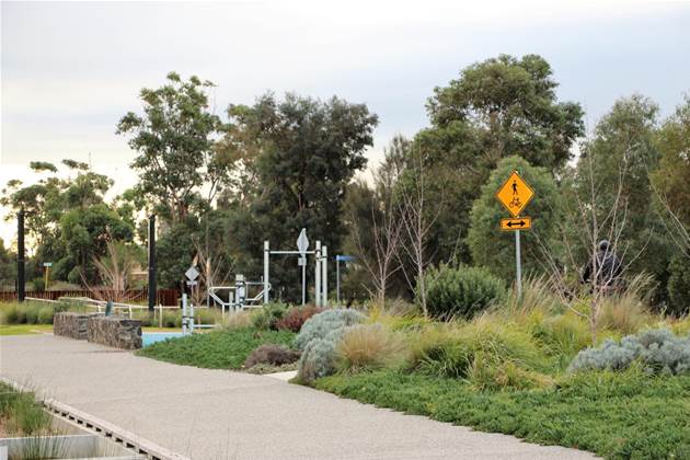
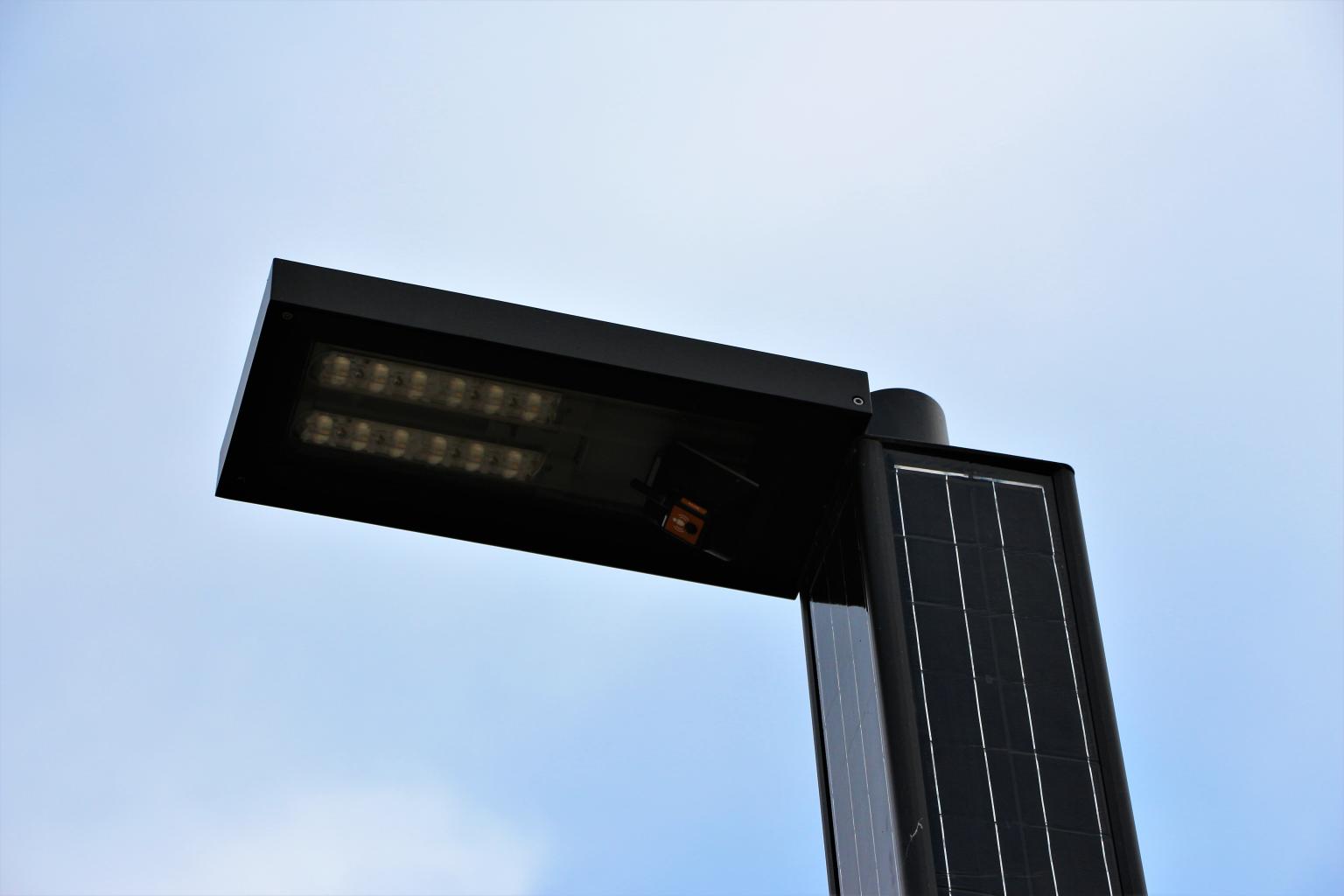
The trial includes a mixture of public wi-fi, phone charging stations, smart bins, smart barbecues and equipment temperature sensors to improve the overall experience at each site, increase safety and provide more environmentally-friendly amenities.
Wyndham City’s Smart City portfolio holder, Councillor Aaron An said the trial will provide the city council with valuable data about how spaces and facilities are being used by the community.
“Through the Smart Parks and Precincts Project, we will be able to identify when BBQs, benches and exercise equipment are being used; access and movement across Wyndham parks and facilities; and outdoor temperatures and humidity,” An said.
“The data will lead to an improved and more efficient operation and maintenance of Council facilities and inform the future design of parks, community centres and other facilities to best meet the dynamic demands of the community.”
So far only three parks -Wyndham Park in Werribee, Greening the Pipeline Pilot Park in Williams Landing and Central Park Community Centre in Hoppers Crossing - have been included in the trial, but An said other parks and facilities may also receive technological upgrades in the future.
“There is scope to potentially use the sensors to monitor grass height in parks and open spaces, and use robotics for lawn maintenance,” An added.
The project is part of Wyndham City’s Smart City Strategy 2019-2024, which outlines the council’s strategy for becoming a digitally connected city and deliver improved services as the region undergoes a significant population increase.
Other efforts to engage residents and developers in the city resulted in the creation of a ‘CityLens’ augmented reality solution that lets users see the visual impact of planned buildings – even down to where their shadows will fall.
The platform also incorporates data visualisation capabilities, displaying live or projected information from internet of things (IoT) sensors to show how the public use spaces and how resources are consumed.


.png&h=140&w=231&c=1&s=0)


.png&w=120&c=1&s=0) Tech in Gov 2025
Tech in Gov 2025
 Forrester's Technology & Innovation Summit APAC 2025
.png&w=120&c=1&s=0) Security Exhibition & Conference 2025
Security Exhibition & Conference 2025
 Integrate Expo 2025
 Digital As Usual Cybersecurity Roadshow: Brisbane edition


.jpg&h=140&w=231&c=1&s=0)
.jpg&h=140&w=231&c=1&s=0)