
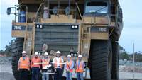
Utilities, mining and resources companies are turning to unmanned aerial vehicles (UAVs) to avoid downtime during infrastructure surveys and assessments.
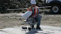
Preliminary mine tower inspections typically require plants to be shut down to stop "steam, heat and possibly toxins" from escaping, according to Cyber Technology project manager Joshua Portlock.
"Normally the process would be to fully shut down the plant ... then they have to get it all certified safe for people to climb and set up all their rigging," Portlock says.
"The downtime expense on those towers is extraordinary."
Portlock says the vendor's CyberQuad UAV has been used to conduct "several ... external inspections" of operating mine towers.
"It's not dangerous for the CyberQuad to be flying near a hot tower as long as you're keeping it within its temperature limits, and we've got alerts and warnings for that," he says.
"We fly around outside or up and down in strips, and take ... lateral photos to build up a vertical mosaic of the whole tower.
"From that imagery, the inspection crew can identify any major concerns or areas that need a closer inspection or a possible repair.
"Once they build up that plan based on that preliminary inspection, they can much more cost effectively shut [the mine tower] down and send people up to get the job done quicker, in and out."
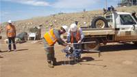
Other operators are finding success in environmental monitoring applications on- and offshore, and monitoring for any subsidence above or adjacent to underground mines.
"If you're operating at sea - LNG is a classic example - how do you continuously monitor what's happening around the platform?" UAVs Australia's Mark Stevens says.
"It's very easy to fly periodically a UAV mission around those platforms and then using software [to] do a comparative analysis of the environmental state, either day-to-day or week-to-week, and ... use that to support environmental work that you're doing to minimise any impact those operations may have."
Other UAV use cases
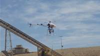
Thermal monitoring is another emerging application. Hot spots can form in coal stock and refuse piles due to a combination of ambient factors - for example, sunlight and oxygen levels.
"We're about to undertake a project up north [where the customer] already has an idea of where coal is burning underground in the spoil, and they want us to fly over with a thermal [camera] and monitor those on a weekly basis to see whether or not their new process of extinguishing that is working," HELImetrex's Ray Gillinder says.
Several pit mapping applications for highwalls, pit walls and development faces (before they are blasted) are beginning to emerge.
Gillinder says highwall mapping can be performed with a downward-pointed camera trained from a UAV.
Likewise, Adam Technology managing director Jason Birch is seeing "a couple of customers" use UAVs they have bought for a different purpose to expand into pitwall mapping.
"Most of our customers just take photos across the pit from the opposite side using terrestrial photogrammetry, but I know a couple of customers [using a UAV], especially where subsidence is occurring," Birch says.
Several operators and surveyors alike see some interest in LiDAR payloads for UAVs. According to the CSIRO, "LiDAR uses laser pulses to generate 3D structural data for terrain and landscape features".
"Payloads in future are going to change," graduate mine surveyor Kiernan Smithson says. "A lot of people now are looking into LiDAR, trying to get operational UAVs running with LiDAR."
HELImetrex's Gillinder is also seeing the trend towards LiDAR, though he cautions that its weight currently discounts it from being carried by anything but large fixed-wing aircraft.
He also says processing times for LiDAR - compared to the current system of offloading UAV-captured data in the field into a software program for analysis - make it a tough proposition.
"The client usually wants that data very quickly," Gillinder says. "We pretty much process onsite in the field. Over a set of stockpiles we can pretty much have that processed inside two hours after capture."
Plug-and-play?
Future applications envisioned by other industry players include shared UAVs and plug-and-play remote operation.
"I know of one company that's ... looking to have fixed wing UAVs that can be deployed from one site, like an airstrip, that cover multiple mines - for example, in the Hunter Valley or Bowen Basin," Smithson says.
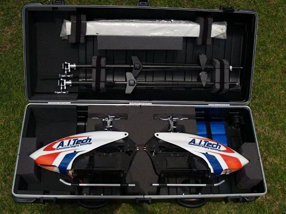
A.I. Tech's Kevin Lunn sees a future where a customer is given a boxed UAV that they plug into a wall.
"When it needs to be used it'll be pulled out, blades unfolded and turned on," he says.
"We'll hook into it from [our] office and do the whole flight from our office in Perth or wherever we are. The aircraft will do its job , it'll come back, land and then be rolled back into the box, put back into a container and plugged in again until next time".
Read on to find out how UAVs could transport spare parts to offshore platforms and regulatory roadblacks to such a service.


.jpg&h=140&w=231&c=1&s=0)


.png&w=100&c=1&s=0)


 SAP NOW AI Tour ANZ
 Forrester's AI Forum Sydney
 The 2026 iAwards
.jpg&w=120&c=1&s=0) Integrate 2026
Integrate 2026
 Security Exhibition & Conference


_(1).jpg&h=140&w=231&c=1&s=0)


