
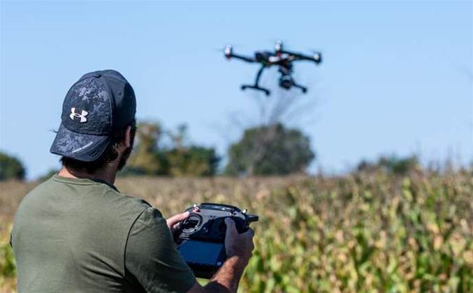
The Victorian government has sent a strong signal it thinks long drone flights will become a regular part of its environmental management, including back burning, pest management, erosion monitoring, and assessments of state-operated dams.
The state’s environment department is putting together a panel of certified drone operators, with formal tenders due to open at the start of February.
It is looking for high-intensity drone services that will require special approval from the Civil Aviation Safety Authority, like beyond visual line-of-sight operations above CASA’s 400ft flight cap, with “high endurance” flight sessions potentially lasting more than four hours at a time.
The panel will work alongside an existing group of suppliers the department has already engaged to deliver more conventional drone services below 400ft.
From a fire management perspective, the Environment department said “improving aerial video and thermal imagery capability will assist [the department] to deliver more effective and safer planned burn operations”.
The agency also thinks it can save money by sending drones out to systematically map the bush roads and fire trails it manages, to send back “geographically referenced” images of any hazards that may pop up, like fallen trees or large animals.
The unmanned flights would prevent the department from having to send park rangers out to monitor or fix blocks on the roads.
It has already flagged that it will ask successful bidders to collect high resolution still and video, infrared and thermal footage from the flights, plus LiDAR data and “orthorectified” (flattened terrain) images of the countryside below.
The panel could see business coming through from the panel until 2020 at the latest.

.jpg&h=140&w=231&c=1&s=0)

1.jpg&h=140&w=231&c=1&s=0)


.png&w=100&c=1&s=0)


 SAP NOW AI Tour ANZ
 Forrester's AI Forum Sydney
 The 2026 iAwards
.jpg&w=120&c=1&s=0) Integrate 2026
Integrate 2026
 Security Exhibition & Conference


_(1).jpg&h=140&w=231&c=1&s=0)


