
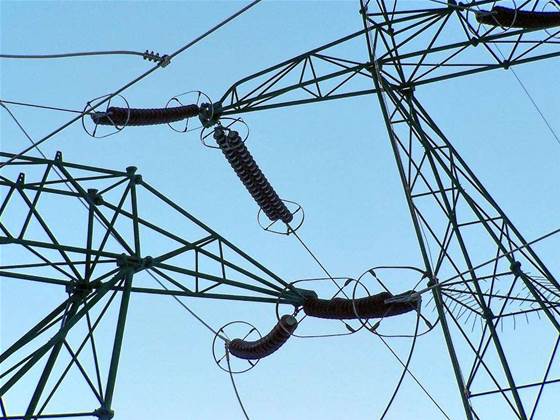
Queensland utility Ergon Energy has announced plans to build an interactive, 3D map of its electricity network on Google’s newly launched Earth Builder product.
The partnership was announced today by Queensland's Minister for Energy Stephen Robertson, who said Ergon was one of only two companies worldwide to have signed up for Google Earth Builder.
Ergon planned to use Google’s product to process and visualise data from its Remote Observation Automated Modelling Economic Simulation (ROAMES) project.
A joint project of the Queensland University of Technology, Seabird Aviation, the Queensland Government, and industry partners, ROAMES was expected to collect terrain data on some 150,000 kilometres of Ergon’s powerlines.
Light aircraft equipped with LIDAR technology would begin collecting data this August.
The data would then be uploaded onto Google’s cloud to be stored in offshore data centres, primarily in the US and Europe, The Australian reported today.
Ergon planned to use Google Earth Builder to process data into spatial layers, and present it in an interactive, 3D visualisation environment.
According to Minister Robertson, the project and collaboration would improve decision making so Ergon could better manage its assets and respond to disasters.
Ergon Energy CEO Ian McLeod said ROAMES information would initially be used to scope and schedule its vegetation management program, from which it hoped to save $44 million over five years.
Looking forward, ROAMES simulations were also expected to assist Ergon in planning for, or responding to, natural disasters or growth.
“But this is not just about cost savings, this is about providing our customers with improvements in their power supply reliability and improving community safety,” McLeod stated.
“This is a very exciting and innovative project for Ergon Energy which will ultimately benefit customers with a more reliable electricity service.”

.jpg&h=140&w=231&c=1&s=0)
.jpg&h=140&w=231&c=1&s=0)


.png&w=100&c=1&s=0)


 SAP NOW AI Tour ANZ
 Forrester's AI Forum Sydney
 The 2026 iAwards
.jpg&w=120&c=1&s=0) Integrate 2026
Integrate 2026
 Security Exhibition & Conference


_(1).jpg&h=140&w=231&c=1&s=0)


