
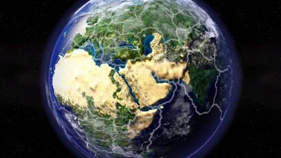
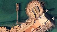
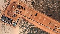
Perth-based aerial mapping company Nearmap has released a series of detailed images of mining sites in Australia’s north-west, captured using custom-built cameras and stitched together using a supercomputer.
The company charters aircraft to fly over designated areas of Australia at regular intervals for customers primarily in the government, utilities, insurance, property and resources industries, creating high resolution photo maps.
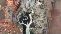
Sales director Adrian Young said the company had flown over 5000 square kilometres of Australia’s north-west last month [see low-res gallery of mining sites] as a “speculative” exercise.
“The scale of Government and commercial investment and the pace of development [in the North West] is unprecedented,” he said.
“A lot happens on a mine site over time. Operators of open cut mines want to be able to monitor and measure pit volumes, measure stockpiles and assess environmental compliance.
“When you get deeper into the production phase, the pit changes in shape and depth. Aerial photography opens up new efficiencies rather than having people on-site all the time, and there are safety payoffs in having fewer people on site.
“We can give clients an ability to see what’s on the ground now and how it’s changing from the desktop.”
Young said the company will most probably fly over the North West sites every quarter, but may look to conduct fortnightly or monthly flights if customers require.
Two-day turnaround
Where other aerial mapping providers might take months to stitch together photos into a seamless map for customers, Nearmap attempts in many cases to turn around maps within two days.
The company has built its own supercomputer cluster using commodity hardware to automatically “mosaic” a sequence of aerial photographs into a seamless photo map. This approach saves the company’s staff from manually matching elements across images to stitch and blend photos together.
The company has invested in data centre space in both Perth and Sydney to ensure it can serve these maps to many thousands of simultaneous users, either over its website or via API integration with the GIS systems of its customers.
During the recent Brisbane floods, the company flew 700 square kilometres over affected areas and had the first detailed imagery available at 2cm resolution within two days, according to Young.

.jpg&h=140&w=231&c=1&s=0)


.png&w=100&c=1&s=0)


 iTnews State of Data & AI Breakfast
 Forrester's AI Forum Sydney
 The 2026 iAwards
.jpg&w=120&c=1&s=0) Integrate 2026
Integrate 2026
 Security Exhibition & Conference


_(1).jpg&h=140&w=231&c=1&s=0)


