
Emergency services, researchers and fire-affected communities in South Australia can now access high-resolution 3D maps of the destruction wreaked by bushfires to aid recovery and future planning efforts.
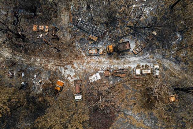
Adelaide-based not-for-profit Airborne Research Australia (ARA) has cobbled the maps together from a combination of LIDAR, RGB cameras and hyperspectral sensors that provides more detailed insights than satellite or ground surveys can produce.
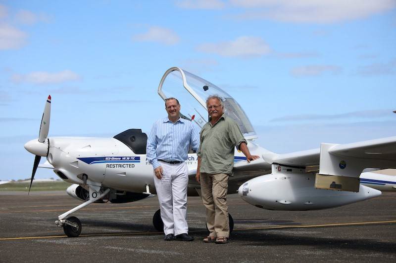
The project was backed by Internode founder Simon Hackett’s philanthropic organisation, which helped ARA launch a series of flights over the Adelaide Hills and Kangaroo Island to collect the imagery of the fire grounds.
Data collected by the slow, low-altitude flyovers was compiled using software donated by UK-based vendor Veesus, providing “centimetre resolution detail,” ARA chief scientist and founder Jorg Hacker said.
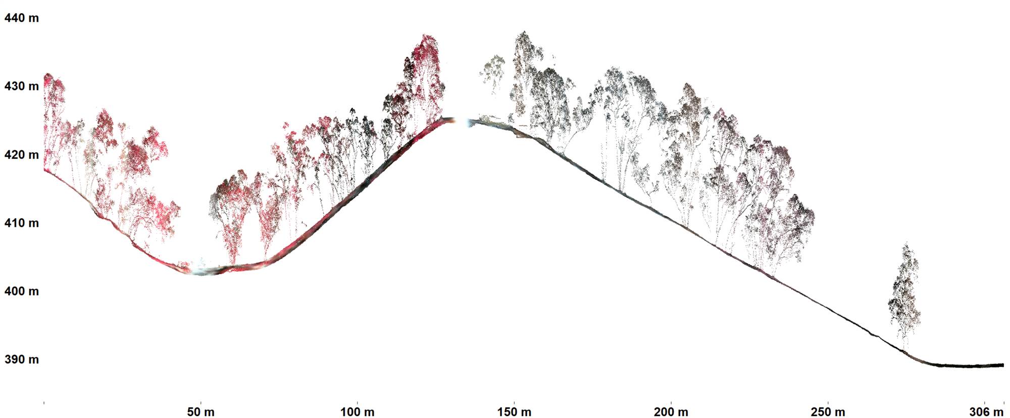
“This lets us both detect the location of such habitats and the state and structure of the undergrowth with LIDAR and even the state of health of the surviving vegetation with hyperspectral scanning.
“We also want to make this data freely available to people in the research community so they can study it and use it to obtain insights that will help communities better prepare against fires and to assist fire defenders to plan their strategies against these unprecedented fire events.”
The first flights were launched over the Adelaide Hills in mid-January, followed by flights over Kangaroo Island last week that focused on the Ravine des Casoars Wilderness Protection Area.
Hacker, also a Professor Emeritus at Flinders University with a background in atmospheric sciences, said the ARA’s purpose-built aircraft gave the organisation an advantage over commercial aerial surveyors.
“In most cases, commercial surveys fly high in order to get coverage of large areas, so you don’t see details,” he said.
“Our planes are derived from a glider, so they can fly low and slow, with minimal fuel usage. We use less than 15 litres of premium unleaded petrol per hour. producing less pollution and less noise, compared with the smallest Cessnas, which use 40 to 50 litres of Avgas per hour.
“Drones are not a viable option for what we do because they cannot carry the sensors we’re using and are limited in their range. Our planes let us cover remote areas such as Kangaroo Island, flying from Adelaide,” he added.
The granularity of the data means pockets of bush that survived the fires readily stand out from the background, while LIDAR data exposes geographical features typically hidden by vegetation - all of which could help direct recovery efforts in the future and identify ways in which the natural landscape can be used to mitigate risk.
“We want to make all this data available to the public - the affected public especially - to help
them recover their landscape, especially the natural landscape,” Hacker said.
“For example, Kangaroo Island has some very deep gullies which the fires may have ‘jumped’ over, so the natural habitats may remain intact in these gullies. Our sensors can map in unprecedented detail landscape and forest features that are not visible with standard aerial photography or satellite data or from the ground.
The data is available from ARA’s website.

.jpg&h=140&w=231&c=1&s=0)


.png&w=100&c=1&s=0)


 SAP NOW AI Tour ANZ
 Forrester's AI Forum Sydney
 The 2026 iAwards
.jpg&w=120&c=1&s=0) Integrate 2026
Integrate 2026
 Security Exhibition & Conference


_(1).jpg&h=140&w=231&c=1&s=0)


