
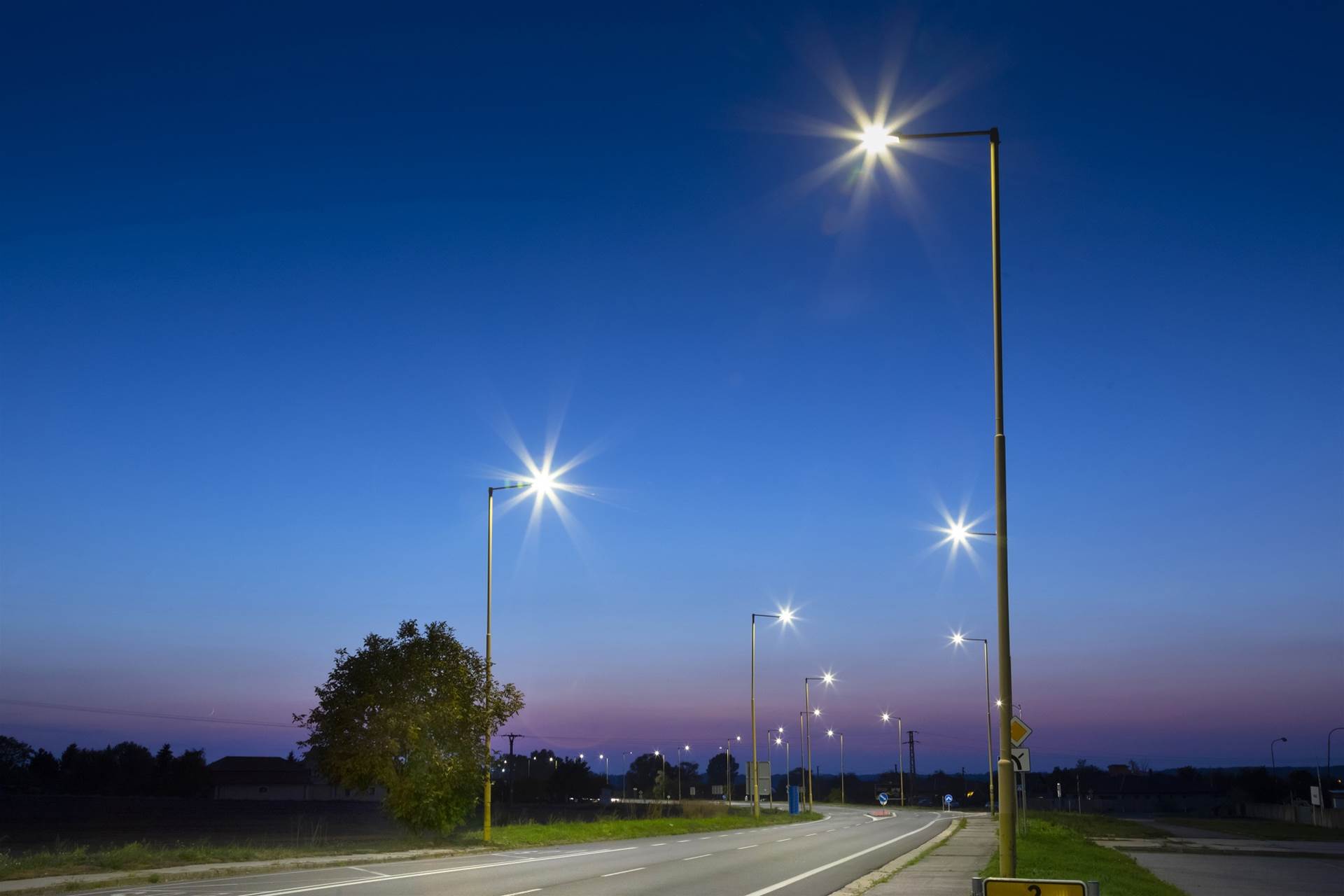
Street lighting is important to the wellbeing of communities and citizens worldwide.

It contributes to perceptions of safety after dark, and extends the hours that people are able to do certain activities.
In addition, different bulbs, colours and levels of lighting can encourage people to visit certain areas after dark, which can play a significant role in the health of night-time economies.
These are just some of the factors that councils weigh when determining the placement and type of street lighting used.
But another important factor is power consumption - and therefore cost. It is, after all, citizens that ultimately pay for street lighting through their local government contributions. The onus is on councils to ensure that money is well spent.
In some states such as Queensland, councils own the lighting network. They know what assets they have, so power usage and maintenance costs are relatively simple to understand.
Contrast that with Hobart, where street poles and lights are owned by either the City of Hobart or by TasNetworks. Without complete overall visibility over the street lighting network, power and maintenance fees are much more difficult to check.
But this will soon change.
Parking and information officers whose workloads were lighter due to COVID-19 hit the streets of Hobart armed with a smartphone and a brand new artificial intelligence-powered app by a start-up called Ordital, to map the street lighting network and build an accurate database of poles and lamps.
Once completed, the database will help the City keep tabs on its lighting costs. It will also inform the development of longer-term strategies “to save energy, protect wildlife, and provide more attractive and appropriate lighting across Hobart,” Director of City Innovation Peter Carr says.
On the evidence
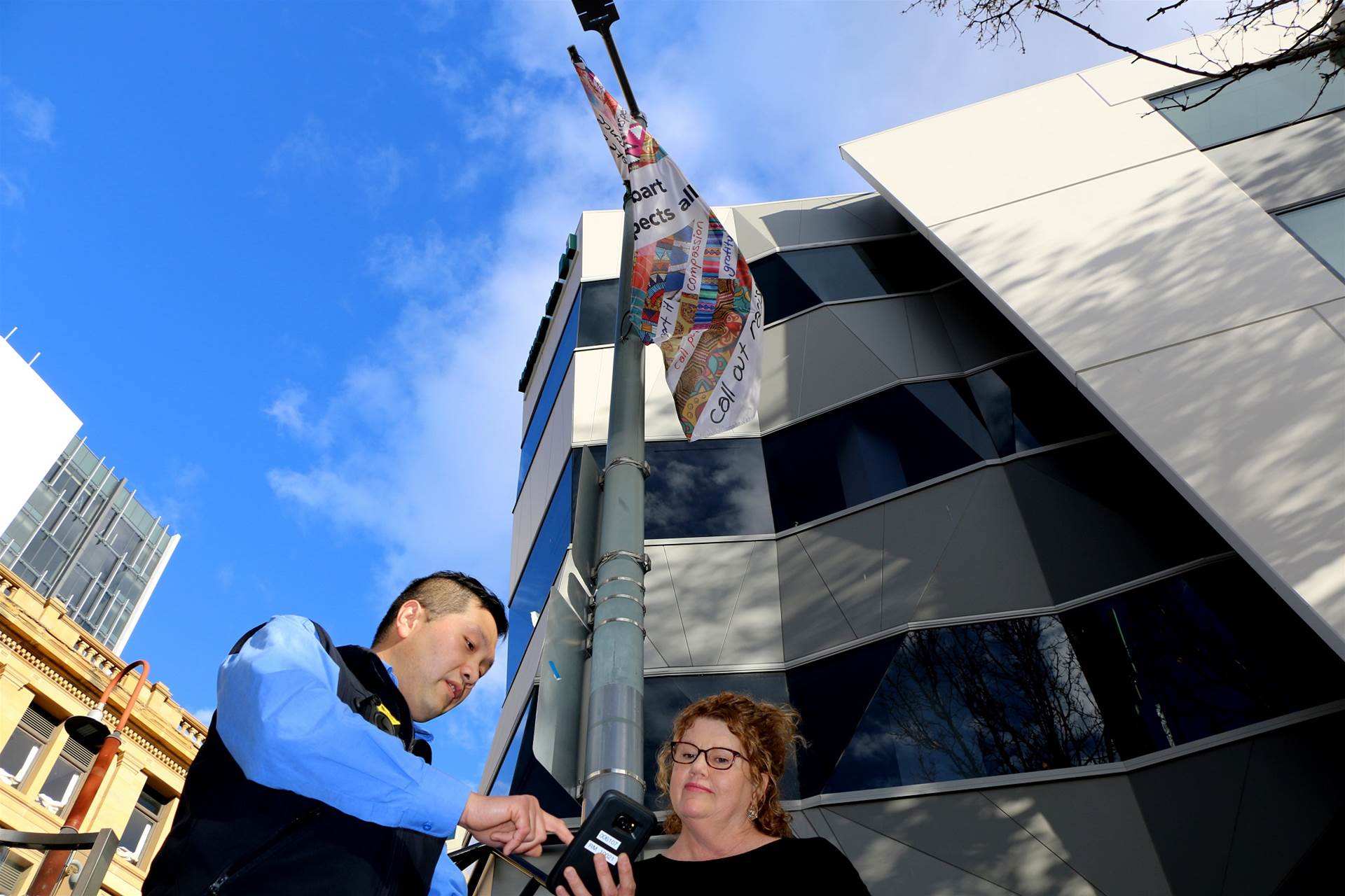
[Above: A City of Hobart Parking and Information Officer and Hobart Lord Mayor Anna Reynolds. Image: Sandra Soccol)]
The City of Hobart receives a “large” annual bill for street lighting electricity usage and asset maintenance from Aurora Energy and TasNetworks, using data held by electricity distributor TasNetworks.
Currently, the City must simply trust that the bill is correct. Historically it has been unable to access the TasNetworks database to check if the street lighting data used to calculate the bill is accurate.
“It has basically been a 'trust us' situation,” Carr says.
“Tasnetworks, as the asset owner, has a database. And like any company on the planet, the database is only as good as the data within it.
“We've had very limited success in getting any insights into that database or the services. Whenever we tried, we were turned away.”
That’s a problem when you consider not all street lamps - luminaires - are the same.
Older street lights use high-energy sodium bulbs and account for around 47 percent of lights across Hobart; the rest are LEDs.
“What we have seen pretty clearly is when we get a bill, we get charged a certain amount for a pole with an LED light versus a pole with a sodium light,” Carr says.
The size of the bill depends entirely on the number of sodium bulbs and LED lamps that TasNetworks says are operating. TasNetworks’ numbers may be correct, but City officials are unsure.
At minimum, they want to be in a position “to ask some really specific questions” about those numbers. For example, the City wants to ensure it can’t be mistakenly charged for running sodium lights in one location when “in actual fact we've installed LEDs.”
On top of electricity, the City pays annual maintenance costs that are “many times larger than the actual energy bill”. Again, the City has no real way of independently cross-checking the basis for this annual bill, nor the efficiency with which maintenance is undertaken.
This is why the council is now building its own database of street lighting assets. It won’t replace the database run by TasNetworks, “but it is going to provide us a whole bunch of wonderful opportunities to get a better deal for our constituents … [by] being able to ask intelligent questions of both TasNetworks and Aurora about this significant asset base,” Carr says.
Inside the app
The AI-powered app was created by Victorian software startup Ordital specifically for the City of Hobart, following open-ended discussions between the two parties.
Carr says the City has embraced working with startups under Connected Hobart, an ambitious five-year plan that sets Hobart on a path to become Australia’s most socially, environmentally and economically inclusive city.
“This wasn't an application Ordital had used in this way before so it wasn't an off-the-shelf service. We'd gotten in contact with them, had some conversations and shot some ideas and asked them what they thought, and they decided to have a crack.
“Within a couple of weeks, we were up and running with a little proof-of-concept.”
A team of three to five officers a day walk each suburb, snapping three photos of each pole and street light. The app uses artificial intelligence to recognise the different markings, asset tags, and type of luminaire in a photo and then automatically populates a database with that information.
The app is able to enhance photos that contain too much glare, for example, and to recognise features of the asset that aren’t visible to the naked eye from the ground, including text on the actual luminaire.
Comments can be entered by speech, video, or text if there is a requirement to add further details.
There is also a “defect” button in the app that gives officers an opportunity to capture suspected damaged assets, which are then immediately flagged in the system.
A human team is looking at a sample of results in the background for assurance purposes, but Carr says the app is so far proving extremely accurate.
“We basically went from a day-and-a-half of trials straight into production because the quality was so good,” Carr says.
At the current pace, Carr expects the survey work and database to be completed in less than two months.
Future of lighting
The database is not just intended to provide a strong evidentiary base for billing and maintenance discussions; it will also be used as a key input to the City of Hobart’s street lighting strategy for the future.
“The City Innovation Division, through its Smart and Sustainable City business unit, is keen to establish a lighting plan, designed to save energy and provide more attractive and appropriate lighting across Hobart,” it said.
“As well as reducing energy and costs, new lighting technology can significantly improve the beauty, night-sky access and night-time amenity of the city, without compromising pedestrian or vehicle safety and security.”
Carr says the City may deploy motion detection sensors on some street lighting in the future, activating when a pedestrian or vehicle comes within range.
The City is also trying to reduce light pollution under a draft initiative called ‘Reclaiming the Dark Skies’, which is presently under community consultation.
“We're using the initiative, which includes night-time drone mapping, to see how much light we're actually throwing up into the night sky and into the universe, which is wasted light and also affects the feeling and ambience of night-time economies and the health of native wildlife populations,” Carr says, adding that this could lead to a rise in the use of softer coloured lighting in the future.
Sensing change in the COVID era
The City of Hobart is tracking on-street and off-street parking occupancy as a barometer of city activity and health as COVID-19 restrictions start to unwind.
It is using a mix of sensors embedded in on-street parking from last year and number plate recognition technology in its off-street car parks to keep tabs on utilisation. Data is being integrated into a single dashboard for “a complete view of our on-street and off-street activity,” Carr says.
“We can see what the occupancy is of all our car parking in the city,” he explains.
“We now know from a couple of years of historical records what's busy and what isn’t. On a normal day, we're very much a commuter city, so we have a lot of extra people come into the city every single day.
“The data is really a wonderful litmus to see what sort of activity is going on across the city.”
In the pandemic era, sensors in public assets and equipment - everything from parking to public BBQs - are likely to take on elevated importance.
Whereas previously the number of uses of a BBQ might determine whether a cleaning crew is dispatched, it might also indicate the recovery of the city.
“There's a real argument to say that if our barbecues are getting a lot of use, maybe we've got people who are connected, they're gathering, they're sharing time and food,” Carr says.
“Whereas if our barbecues aren't being used, then maybe we're more likely to have an unhappy city or less social cohesion.
“I think one of the outcomes of the COVID event in terms of smart city measurement is for us to look at some of these raw sensors and the data and ask, 'what did this measurement really tell us at a time of crisis?'
“It might have told us whether or not people were obeying the rules, or whether or not they felt confident enough to come out.
“Specifically with the barbecues, it might tell us whether or not they were happy and connecting with their families again.”
New uses for people counting
Other councils found COVID-related uses for people counting technology they have installed in public places that are usually used to gauge the extent of foot traffic - and therefore citizen use - of the area.
About 30 councils Australia-wide have deployed nCounter “people counting” devices - and an accompanying analytics platform - made by Meshed IoT.
These small boxes detect wi-fi emitting devices that come within range, timestamps their entry then follows the device until it leaves the zone, Meshed IoT’s co-founder and IoT solutions general manager Paul McManus says.
“It tells you how many people were there at the start of the segment, how many people entered, and how many people left, and what their dwell times were,” McManus says.
“All that data is transferred over the LoRaWAN [a low-power wireless network used for IoT] in 10 minute segments of information, and reconstituted on our nCounter platform.
“It's a good proxy for how many people are present in any particular area.”
Some councils have been examining the possibility of using nCounter to police COVID restrictions at a local level.
“One council told me they want to be able to use the nCounter pedestrian data as a way of alerting their rangers if there's too many people going to a particular place for recreation,” McManus says.
“They can't have a ranger stand there the whole time measuring the distance between people but they can make some assessments by how many people appear to be going to that particular facility to understand whether there’s a high risk of people being too close together and too many people [present].”
Meshed IoT itself also produced a ‘Meshed IoT COVID-19 Pedestrian Index’ throughout the lockdown period, showing - at an aggregated level - how pedestrian activity fell as restrictions in Australia took effect.
“It was really interesting because in the first couple of weeks when people were starting to talk about COVID - so probably late February to early March - you could see that there wasn't much of a change in the level of pedestrian behaviour or traffic,” McManus says.
“Once people started [to] work from home and the government directives started coming out, there was a massive drop … by about 60 percent in that first week from top to bottom. Since then, it's gradually starting to creep back up again.”
Repurposing geospatial data
Geospatial - GIS - data was similarly called upon by local government areas (LGAs) across Australia as part of their COVID responses.
Esri Australia solutions engineer Houtan Emad told the recent Directions conference that Esri conducted a series of virtual roundtables with councils in several states in early April.
“The main goal of these sessions was to provide a platform for discussion among the LGAs themselves around what their most pertinent local challenges were,” Emad says.
“We found that the discussions predominantly fell into one of two categories. The first had to do with the response to COVID-19 directly in the LGA communities and the second category covered the secondary or broader implications of changes to how work was done at the council itself as a result of COVID-19.”
Queensland councils, in particular, showed a strong interest in using “human movement data”.
“What human movement data typically refers to is aggregated and anonymised information that showcases trends in where people tend to travel to at specific times around the city,” Emad explains.
“This kind of information can come from a variety of sources, including pedestrian sidewalk sensors that are typically implemented by much larger city councils, or geospatial packages or geospatial data streams that are provided from third party vendors or data aggregators.
“In the initial stages of the pandemic, having access to human movement data was invaluable to individual city councils as a way of measuring the effectiveness of the social distancing measures they put into place, such as closure of certain facilities like parks and beaches.
“In the later stages, however, having access to this kind of data remains valuable for measuring the effects of gradually easing some restrictions while still trying to maintain those social distancing measures.”
Geospatial data was useful to councils in most states and territories, according to Emad.
In Western Australia, where there were internal road closures aimed at preventing transmission of the virus between different “zones” in the state - council call centres were inundated with citizens requesting information on “which roads they were permitted to travel on and what would constitute a valid reason for travel between zones.”
“These conditions provided a very valid argument for exposure of custom routing tools within a web app, for example, to the public as a way to try to self-serve some of that information and potentially alleviate some of the external pressures on the council's call centres,” says Emad.
In South Australia, Emad says, GIS teams at councils worked quickly to make information available internally and support the needs of their organisations.
“When GIS folks in [SA] councils noticed limitations of throughput with their [corporate] VPN while accessing data within their network, they really quickly started developing Python scripts for publishing the necessary data from their internal data sources to the cloud using ArcGIS Online,” says Emad.
“Another area that left me super-impressed was how some councils were leveraging GIS tools for what might be considered traditionally non-GIS tasks.
“For example, in the move to working from home and digitising everything, one council needed to digitise the standard vehicle mileage claim form that they had for their field staff in a very short period of time, with no additional costs.
“What that council did was to use Survey123 for ArcGIS to quickly configure a form that captured all the needed and necessary information, and then easily distribute that form to their field staff who were using Azure mobility applications, and automatically have that data captured into their GIS system of record upon submission of those forms.”


.jpg&h=140&w=231&c=1&s=0)


 iTnews State of Data & AI Breakfast
 Forrester's AI Forum Sydney
 The 2026 iAwards
.jpg&w=120&c=1&s=0) Integrate 2026
Integrate 2026
 Security Exhibition & Conference


_(1).jpg&h=140&w=231&c=1&s=0)


