
Westwind Energy will use geographic and 3D modelling tools to create the proposed layout of a $750 million wind farm project in Victoria.
The privately-owned company was also behind the Mt Mercer and Lal Lal wind farms. All three are located within 30 kilometres of Ballarat.
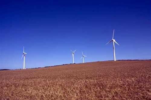
Moorabool, the latest wind project for the company, proposed 128 two megawatt wind turbines, giving it an installed capacity of 256MW.
The wind farm was expected to be able to generate 784GWh of electricity each year - enough to power about 147,000 Victorian homes.
Planning and policy guidelines for wind energy facilities in Victoria forced prospective builders "to go through far more rigorous planning [processes] than any other industry", Westwind's project development engineer Adam Gray told iTnews.
Planned site layouts were created in three stages - initial, indicative and proposed.
The indicative layout was an amendment of the initial one that incorporated constraints set by various stakeholders.
Constraints could be the result of data inputs from engineering, geotechnical, flora, fauna, atmospheric modelling and acoustic consultants. The data was used to assess potential issues including the noise impact of turbines on residential areas and grid interconnection.
Only the proposed layout was submitted for external planning approval.
Wind farms under 30 megawatts of capacity are approved by local government authorities. Those above 30 megawatts are said to be of state significance and automatically routed to the State Planning minister for approval.
"The process from conception to [planning] approval could take one to five years," Gray said.
Westwind switched to ESRI's ArcView geographic information system tool to create the proposed layout of the Lal Lal wind farm in 2007.
The company plans to use the same tool on the Moorabool project, albeit for all three stages of the layout.
Westwind used basic GPS tools including OziExplorer for the initial and indicative plans for Lal Lal. This changed when Gray was employed midway through the project.
Gray said he had been exposed to ESRI Australia in the Department of Defence. He also looked at open source alternatives including Grass GIS.
"At the time my level of understanding of open source was on the low side," Gray said.
"If I knew more about software programming maybe it would be something to look more into, but it would have involved changing the operating systems here [to Linux] which was effectively too hard", he said, given the limited time he had to submit the Lal Lal plan for state government approval.
Gray said the advantages of ESRI Australia were being able to "import data from multiple sources, package it together and present it in a visual format that made it easy for state planning teams to understand what we're applying for."

.jpg&h=140&w=231&c=1&s=0)


.jpg&h=140&w=231&c=1&s=0)


 iTnews State of Data & AI Breakfast
 Forrester's AI Forum Sydney
 The 2026 iAwards
 Security Exhibition & Conference
.jpg&w=120&c=1&s=0) Integrate 2026
Integrate 2026


_(1).jpg&h=140&w=231&c=1&s=0)


